Drone Land Surveying & UAV Mapping for {{COUNTY}} County
Drone LiDAR mapping and aerial survey services for developers, contractors, and engineers, from our licensed surveyors serving {{COUNTY}} County and the surrounding areas of {{STATE}}. High-resolution topographic data, 3D models, and orthomosaic imagery, with field data captured quickly from the air.
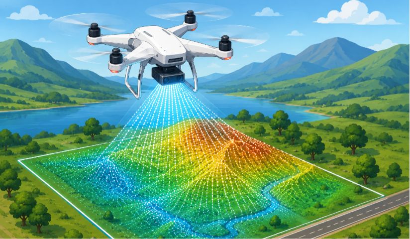
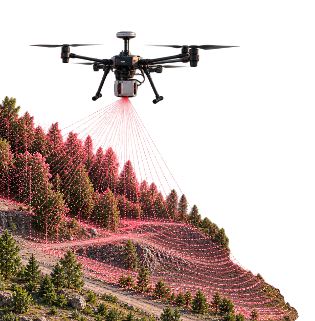
Drone LiDAR mapping uses unmanned aerial vehicles (UAVs) equipped with LiDAR sensors to capture high-resolution, three-dimensional data of the ground surface. LiDAR - Light Detection and Ranging - fires rapid laser pulses at the ground and measures the return time to calculate precise distances, producing a dense point cloud of the terrain.
Unlike traditional ground surveying methods that require a crew to walk the entire site, drone land surveying with LiDAR collects data from above in a single flight. This makes it significantly faster, safer, and more cost-effective for large or difficult-to-access sites. LiDAR can also penetrate vegetation canopy, making it ideal for wooded parcels and brush-covered terrain where photogrammetry cannot produce accurate ground models.
What once required a manned aircraft to produce can now be captured by a drone in a fraction of the time & at a fraction of the cost.
02Comparison
Drone LiDAR vs Photogrammetry
Both LiDAR and photogrammetry use drones to capture aerial data, but they work very differently. The right choice depends on your terrain, your deliverables, and your project in {{COUNTY}} County.
Lidar
Penetrates vegetation & tree canopy to reach bare ground
Works in low light, overcast, & cloudy conditions
Direct distance measurement using laser pulses
Higher accuracy in dense brush, forests, & wooded parcels
Ideal for bare-earth terrain models (DTM) & DEM generation
Photogrammetry
Uses high-resolution aerial photos to create 3D models
Produces true-color orthomosaic imagery for visual site docs
Lower cost for open, clear terrain with good ground visibility
Requires good lighting, clear weather, & minimal vegetation
Ideal for construction sites, open land & progress monitoring
03Applications
Drone Mapping Applications in {{CITY}}
Drone LiDAR mapping and aerial surveying provide accurate, up-to-date spatial data for a wide range of projects in {{COUNTY}} County. From topographic surveys to construction site monitoring, drone-based data collection helps developers, engineers, contractors, and property owners make informed decisions faster and at a lower cost than traditional ground surveying methods.
Topographic Surveys
Drones capture high-resolution elevation data and generate accurate topographic contour maps for site planning, grading plans, and land development projects in {{COUNTY}} County. Significantly faster than ground-based methods, especially on large or wooded parcels.
Construction Site Mapping
Regular drone surveys create a visual and topographic record of construction progress. Contractors use aerial data for earthwork volume calculations, cut and fill verification, grading checks, and progress billing documentation throughout the project lifecycle.
Stockpile Volume Calculations
Drone surveys measure stockpile volumes for mining operations, quarries, and material yards in {{STATE}}. Aerial data produces accurate volume reports and cut and fill quantities in minutes without sending a ground crew onto hazardous terrain.
Land Development and Planning
Developers use drone mapping to assess sites before design and generate existing-conditions topographic data in {{CITY}}. High-resolution orthomosaic imagery provides a current, accurate view of the property - far more detailed than outdated satellite imagery.
ALTA Survey Aerial Support
Drones capture aerial imagery overlaid with ALTA survey drawings, providing orthorectified photo-enhanced survey deliverables. The aerial image is controlled to match the precisely run survey lines - something standard satellite imagery cannot achieve.
3D Site Models
Drone data is processed into 3D reality models and digital surface models for visualization, analysis, and design. Useful for developer proposals, zoning presentations & integration with CAD and BIM workflows for civil engineering teams in {{COUNTY}} County.
Not sure if drone mapping fits your project? Call {{PHONE}} and we'll help you figure it out.
04Why Drone Surveying
Benefits of Drone Aerial Surveying
Drone LiDAR mapping delivers accurate data, faster timelines, and greater insight for projects in {{COUNTY}} County. Here's why developers and contractors choose drone surveying over traditional ground methods:
Faster field data collection - many sites captured in a single flight instead of days of ground work
Safer site access - no crews in hazardous terrain, roadways, or steep slopes
Dense point cloud coverage - millions of data points with no gaps or interpolation
Cost-effective alternative to manned aircraft and helicopter surveying
LiDAR vegetation penetration - accurate bare-ground data through tree canopy
Current high-resolution aerial imagery - far more detailed than satellite data
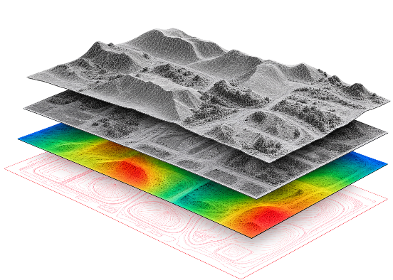
A drone LiDAR mapping survey delivers a comprehensive set of geospatial data and drawings. While deliverables vary by project scope, a typical drone survey in {{STATE}} includes the following:
1
3D Point Cloud
A dense, classified point cloud in LAS or LAZ format capturing millions of laser returns from the ground, vegetation, and structures. The raw 3D data that all other deliverables are derived from.
2
DEM / DTM
Digital elevation models showing bare-earth terrain with vegetation and structures removed. Used for grading plans, drainage analysis, and flood modeling in {{COUNTY}} County.
3
DSM
Digital surface model including all above-ground features - vegetation, buildings, and structures. Used for viewshed analysis and 3D visualization of existing site conditions.
4
Orthomosaic Map
A georeferenced aerial image where the photo matches survey coordinates exactly. Unlike satellite imagery, it lines up perfectly with property boundaries and survey data for accurate site documentation in {{CITY}}.
5
Contour Map
Contour lines generated from the bare-earth DTM at the interval your project specifies, showing the shape and slope of the ground. Used for grading, drainage, and site design, and delivered in CAD and GIS formats.
6
Volume Reports
Stockpile and earthwork volume calculations with cut and fill quantities and material inventory - calculated from the 3D point cloud with precision.
06Service Areas
Drone LiDAR Survey Service Areas in {{CITY}}
Our licensed surveyors serve property owners, lenders, and real estate professionals throughout {{COUNTY}} County and the surrounding areas of {{STATE}}.
Drone LiDAR mapping uses an unmanned aircraft carrying a Light Detection and Ranging sensor to collect three-dimensional measurements of the terrain and surface around a site. The sensor emits laser pulses and records the returning signals, producing a dense point cloud that can be processed into mapping and elevation products.
Accuracy varies substantially with the sensor, flight planning, positioning system, control, terrain, vegetation, processing, and project specifications. Rather than promising one universal centimeter figure, the survey scope should identify the required accuracy and the quality-control methods used to achieve it. Ground control and independent check points can be important when survey-grade deliverables are required.
Field collection can often be completed quickly, especially on large open sites, but the total project time includes flight planning, setup, control, data processing, classification, quality control, drafting, and deliverable preparation. Actual timing depends on the project scope.
LiDAR measures distance using laser pulses and produces a three-dimensional point cloud. Photogrammetry uses overlapping photographs and image-processing techniques to reconstruct three-dimensional information and create products such as orthomosaics and surface models. LiDAR can be particularly useful where vegetation makes visual photogrammetry difficult, but the right method depends on the project's accuracy, terrain, vegetation, and deliverables.
Drone mapping is usually quoted according to site size, terrain, vegetation, flight requirements, control, required accuracy, data products, processing, and project complexity. There is no reliable one-size-fits-all price. A small open parcel and a large wooded development site can require very different amounts of field and processing work.
LiDAR pulses can pass through gaps in vegetation canopies, allowing some returns from the ground beneath trees. That makes LiDAR useful for mapping terrain in vegetated areas where conventional aerial imagery may have difficulty seeing the ground. However, canopy density, sensor characteristics, flight conditions, and processing methods affect how much ground can actually be recovered.
Depending on the project, deliverables can include classified point clouds such as LAS or LAZ, digital elevation or terrain models, digital surface models, orthomosaic imagery, contours, CAD data, and volume calculations. The exact deliverables, coordinate system, vertical datum, accuracy, and file formats should be agreed upon before the survey begins.
Drone mapping can complement or, for certain mapping tasks, reduce the amount of conventional fieldwork required. It is not a universal replacement for ground surveying. Boundary determination, monumentation, legal boundary analysis, and other professional survey tasks may still require conventional measurements and field evidence. A combined aerial-and-ground approach is often useful when the project requires both coverage and precise control.
Commercial small-drone operations in the United States generally operate under the FAA's Small UAS Rule, Part 107, and require a Remote Pilot Certificate unless another applicable authorization or operating framework applies. The FAA states that a person flying under Part 107 must obtain a Remote Pilot Certificate and keep it current. Airspace authorizations may also be required in certain locations or circumstances.
Yes. The survey deliverables from our drone projects are prepared under the responsible charge of a land surveyor licensed in {{STATE}}. The drone pilot and the professional surveyor are separate qualifications: a commercial drone operation may require an FAA Remote Pilot Certificate, while professional surveying work requires authorization under the applicable state law. We identify the licensed surveyor responsible for the surveying work, along with the applicable drone credentials, for each project.
Request a land surveying quote
Send us a quick inquiry below for your land surveying needs and we will get back to you within 2-3 business days.