Flooding can turn a home that feels safe and familiar into a property that requires extensive cleanup, repair, and professional evaluation. The financial impact can vary greatly from one property to another, but the depth of water and the parts of the home that are affected are two of the most important factors to understand.
If you are buying a home, building a new house, developing property, or simply trying to understand your existing property's flood risk, learning how flood exposure relates to elevation is a useful place to start.
A flood damage estimate is not only about the cost of replacing damaged materials. It is also about understanding why one property may experience very different consequences from another property during the same flood event.
What Determines the Cost of Flood Damage
There is no single dollar amount that applies to every flooded home.
Flood damage can depend on the depth of the water, how long water remains inside the structure, the materials used in the home, the foundation and construction type, the location of electrical equipment and mechanical systems, the condition of floors and walls, and the belongings inside the property.
A shallow amount of water can affect flooring, baseboards, drywall, cabinets, appliances, furniture, and other finished areas. Deeper flooding can reach electrical systems, heating and cooling equipment, structural components, and other expensive parts of a home.
The larger the affected area and the greater the depth, the more extensive the potential cleanup and repair work can become.
This is why understanding flood risk before a flood occurs can be more useful than trying to calculate the cost afterward.
Why Flood Risk Matters Before You Buy a Home
When buying property in {{CITY}}, it is worth understanding more than the home's appearance and purchase price.
Flood risk can affect insurance decisions, construction planning, property improvements, and the overall way a buyer evaluates the property.
FEMA publishes Flood Insurance Rate Maps, commonly called FIRMs, that show mapped flood hazard information. These maps can identify Special Flood Hazard Areas, flood zones, Base Flood Elevations, and other information used in floodplain management.
A FEMA flood map is an important source of information, but it is a map based on mapped flood hazard information. It does not replace a site specific measurement of a building's actual elevation.
That distinction matters when the question is not simply whether a property appears within a mapped area, but how the building elevation relates to the flood information for that location.
What Is a Flood Zone Survey
A flood related survey can provide measurements that help describe the elevation of a property or structure in relation to floodplain information.
Depending on the project scope, a surveyor may collect relevant building elevations, ground elevations, and other measurements needed for an Elevation Certificate or another professional evaluation.
The exact information required depends on the building, the FEMA form or project requirement, the local jurisdiction, and the purpose for which the information is being collected.
This is why a flood zone map and a survey are not interchangeable. The FEMA map provides mapped flood information. The survey provides site specific measurements. Both can be useful when evaluating a property.
What Is an Elevation Certificate
An Elevation Certificate is a FEMA form used to document elevation information for a building and property.
Depending on the structure and survey data, an Elevation Certificate can document information about the lowest floor, adjacent ground elevations, flood zone information, Base Flood Elevation, and other required items.
State law, including in {{STATE}}, regulates the practice of land surveying, and FEMA's form instructions call for surveyed elevation information to be certified by a land surveyor, engineer, or architect authorized by state law to certify it. The responsible professional should use the current FEMA requirements and the applicable state and local requirements for the project.
An Elevation Certificate is not a guarantee of a particular insurance premium, and the certificate by itself does not automatically remove a property from a mapped flood zone.
Instead, it provides documented elevation information that may be used for floodplain management, insurance evaluation, or a FEMA map change request when the circumstances support one.
Understanding BFE and Property Elevation
Base Flood Elevation, commonly abbreviated as BFE, is an important floodplain term.
In simple terms, it represents the elevation associated with the base flood used in FEMA floodplain mapping and management.
A property's actual elevation can be compared with applicable flood information when evaluating flood risk.
For example, a building whose lowest floor is above the relevant Base Flood Elevation may have a different flood risk profile from a building whose lowest floor is below it.
The exact significance depends on the flood zone, building characteristics, local requirements, insurance rating rules, and other factors. This is another reason why relying on a general online map alone may not answer every question a property owner has.
How Water Depth Affects Flood Damage
When estimating potential flood damage, water depth is a critical variable.
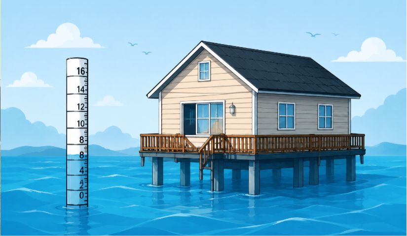
Imagine two similar homes exposed to the same flood event. If water reaches only the lowest exterior areas at one home but rises high enough to reach electrical equipment, finished walls, cabinets, mechanical systems, and living areas at another, the repair requirements can be very different.
The purpose of a flood damage estimate is therefore not to provide a universal price. It is to help a property owner understand how increasing water depth can increase the portion of a home that is exposed to damage.
For an actual property, the structure, contents, construction materials, site elevation, drainage, and flood characteristics should all be considered.
Flood Insurance and Property Elevation
Flood insurance is a separate consideration from the survey itself.
Homeowners insurance policies generally have exclusions and limitations concerning flood damage, which is why property owners in flood prone areas may need to consider separate flood insurance.
The appropriate insurance professional determines available coverage and the applicable premium based on the policy and current rating requirements.
An Elevation Certificate can supply surveyed elevation information used in an insurance evaluation, but it does not guarantee that a premium will decrease. Likewise, a property owner's belief that the home has never flooded should not be treated as proof that the property has no flood risk.
Why Check a FEMA Flood Map Before Building
Flood information can be especially important before new construction.
When planning a home or improvement project, understanding the mapped flood zone and relevant elevations can help the owner and design team identify requirements that may affect planning.
Depending on the property, the project may involve local floodplain rules, building requirements, elevation requirements, drainage considerations, insurance decisions, or additional documentation.
A property surveyor, engineer, architect, insurance professional, and local authority may each have a different role in evaluating these issues.
Do You Need a Flood Survey Before Buying Property
A flood survey or Elevation Certificate may be useful when a property is in or near a mapped flood hazard area or when an elevation related decision needs documented measurements.
Whether one is required depends on the specific transaction and the requirements of the lender, insurer, municipality, floodplain authority, or other party involved.
A buyer should ask what information is needed before ordering a survey so the surveyor can provide the appropriate scope.
Get the Property Information Before the Decision
The best time to understand flood risk is before a major property decision is made.
If you are buying a home in {{CITY}}, building in {{COUNTY}} County, reviewing a FEMA flood zone, or trying to understand an existing property's elevation, start with the available flood map information and ask the appropriate professional whether site specific elevation information is needed.
At {{SITE_NAME}}, our licensed surveyors can discuss the appropriate flood related survey service for your property, including Elevation Certificates. Call {{PHONE}} or submit a quote request to get started.
Get a Quote